Home | Gallery | AboutUs | Software | Rates
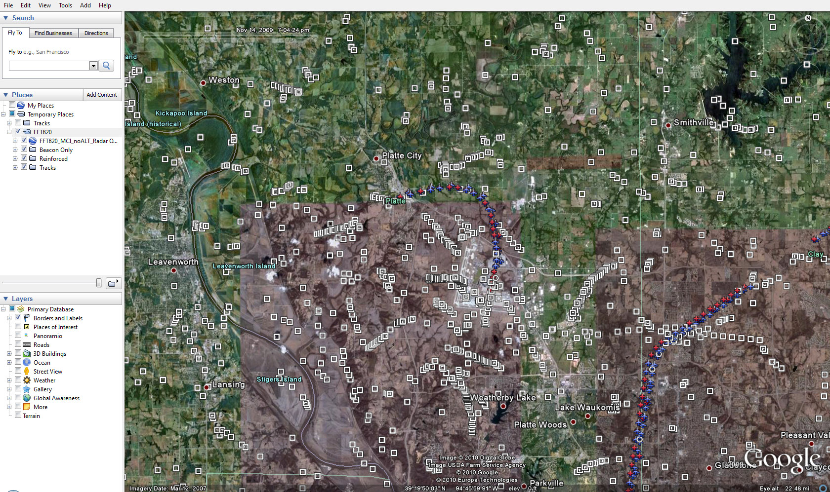
On November 14, 2009, Frontier Flight 820 departed Kansas City International (KCI) destined for Denver International Airport (DIA). Shortly after takeoff, the aircraft hit birds and lost power in the number two engine. We have processed the radar data (obtained by FOIA request) using our custom software for a quick visualization solution using Google Earth. This has allowed us, in a relative short amount of time, to preview the timelapse of the data and ascertain the prevalence of raw radar returns associated with flocks of birds. This data is very similar to the Hudson River Flight 1549 accident, for which we have a complete 3D reconstruction and animation.
Our analysis confirms that at a time of around 7:04:25pm (local time), the accident aircraft encountered a track of primary returns moving from west to east at a velocity consistent with birds or other slow moving objects. There are an abundance of tracks that appear to be associated with birds in this particular radar data set. Like our 1549 analysis, the data is available from two different radar sites, making it possible to triangulate the altitude of the birds. Accuracy of this analysis would be very limited, but it is possible there is a technique that could obtain a solution.
Copyright 2010 Exosphere3D.com